The Islamic Republic of Pakistan is the world’s 36th largest country. Located in South Asia and has a total area of 796,096 sq km. The land mass of Pakistan is an oblong stretch of land between the Arabian Sea and Karakoram mountains and situated between 24.50 and 36.75 latitude north and 61 to 75.5 longitude east and covering an area of 87.98 million hectares.
Details of the Surroundings
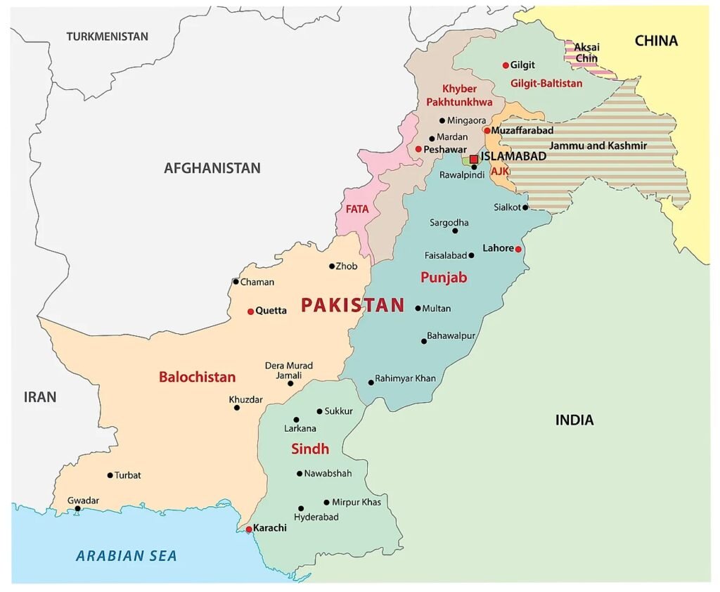
Pakistan is bordered by India to its east, which has a 2,912 km (1,809 miles) border with Pakistan. To the west is Iran, with a 909 km (565 miles) border with Pakistan. To Pakistan’s northwest lies Afghanistan, with a shared border of 2,430 km (1,510 miles). China is towards the northeast and has a 523 km (325 mile) border with Pakistan. To the south is the Arabian Sea, with 1,046 km (650 miles) of coastline. A panhandle of Afghanistan territory in the northwest, the Wakhan Corridor, separates Pakistan and Tajikistan. Jammu and Kashmir is a disputed territory located between Pakistan and India.
Topographically, Pakistan has a continuous massive mountainous tract in the north, the west, and southwest and a large fertile plain, the Indus Plain. The northern mountain system, comprising the Karakoram, the great Himalayas, and the Hindu Kush, has an enormous mass of snow and glaciers and 100 peaks of over 5,400 m. in elevation. K-2 (the second-highest peak in the world). The mountain system occupies one-third of this part of the country.
For more information visit: http://pakistanpaedia.com/land/geo_1.html
Neighborhood Map of Pakistan
For more details visit:
- Pakistan Bureau of Statistics: www.pbs.gov.pk
- Minister for Finance, Revenue, Economic Affairs, Statistics, and Privatization: www.ead.gov.pk