Hushe Valley Pakistan: Complete Guide to Treks, Culture, and Logistics
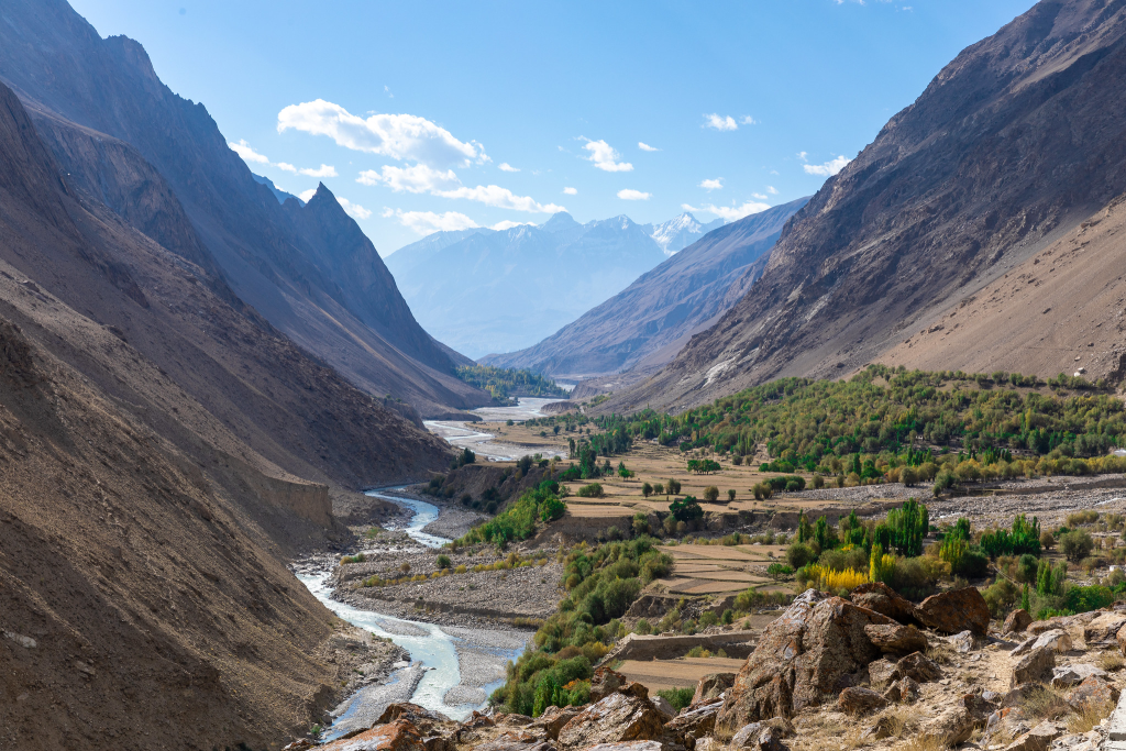
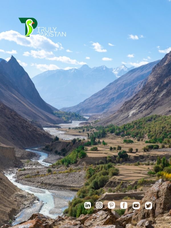
At the far end of Baltistan lies Hushe Valley, a high-altitude gateway to some of the world’s most iconic peaks. Perched at 3,050–3,600 meters, it is the last permanently inhabited settlement before the great Karakoram glaciers begin. For trekkers and culture-seekers alike, Hushe offers both adventure and an authentic glimpse into Balti life.
Quick facts about Hushe:
- Location: Ghanche District, Gilgit-Baltistan, Pakistan
- Elevation: 3,050–3,600 meters above sea level
- Major Peaks Nearby: Masherbrum (7,821m), Laila Peak (6,096m), K6 (7,281m), K7 (6,934m)
- Access: 140 km from Skardu (6–8 hours by road)
- Tourist Season: June to September
Table of Contents
What Is Hushe Valley? Location, Elevation, and Why Hushe Matters
Hushe in the Karakoram: Geography, Sub-Valleys, and the Hushe River
The Hushe Valley stretches south of the mighty Karakoram, carved by the Hushe River that joins the Shyok near Khaplu. It is surrounded by sub-valleys such as Gondogoro, Charkusa, Nagma, and Nanbroq. Each sub-valley leads towards glaciers and high-altitude passes that have attracted explorers for more than a century.
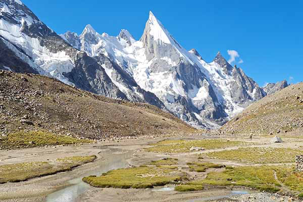
Signature Peaks Around Hushe: Masherbrum (K1), Laila Peak, K6, K7, Link Sar
The skyline above Hushe is dominated by giants. Masherbrum (K1), often called the “Queen of Peaks,” rises to 7,821 meters. Laila Peak, with its iconic spear-like shape, is one of the most photographed summits in the Karakoram. The twin massifs of K6 (7,281m) and K7 (6,934m) overlook the Charakusa Glacier, while Link Sar (7,041m) adds to the panorama of unclimbed challenges.
Hushe vs Other Baltistan Gateways: What Makes Hushe Different
Unlike Concordia or Fairy Meadows, which are reached via multi-day approaches, Hushe is directly accessible by jeep. This makes it a living village surrounded by expedition routes rather than a temporary base. It is one of the few places where travelers can experience Balti hospitality while being only a day’s walk away from glaciers and base camps.
How to Reach Hushe: Islamabad → Skardu → Khaplu → Hushe
Road Conditions and Realistic Drive Times to Hushe
Getting to Hushe Valley is a journey in itself. Most visitors first fly or drive to Skardu. From Skardu, it’s a 140 km drive through Khaplu to Hushe, usually taking 6–8 hours by jeep. Roads are narrow, winding, and can be blocked by landslides in summer or snow in spring and autumn. Patience is required, and drivers familiar with mountain routes are strongly recommended.
Public Transport, Shared Jeeps, and Private 4×4 Options to Hushe
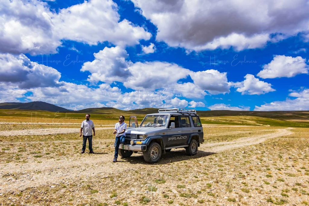
Public transport beyond Khaplu is limited. Shared jeeps operate irregularly between Khaplu and Hushe, often waiting for enough passengers before departure. For more reliable travel, most trekkers hire private 4×4 vehicles from Skardu. While pricier, these allow flexibility in timing and stops, particularly if traveling with gear or in groups.
Navigating Permits, Checkpoints, and Seasonal Closures Near Hushe
Traveling to Hushe involves crossing several checkpoints where permits may be checked, especially for foreign tourists. Seasonal closures are common during winter months when snow isolates the valley. Always confirm road conditions in Skardu before departure, and plan buffer days in case of unexpected delays.
Best Time to Visit Hushe (Month-by-Month Conditions)
Weather in Hushe by Season: Temperatures, Precipitation, Daylight
The main trekking season in Hushe Valley runs from June to September, when daytime temperatures range between 10–22°C. Nights can drop below freezing at higher camps. Snowfall lingers on glaciers well into June, while late summer offers clearer skies. Monsoon influence is weaker here than in other regions of Pakistan, but occasional rains can still cause roadblocks.
Trail Status in Hushe: When Key Routes Typically Open/Close
Trails to Masherbrum Base Camp, K6/K7, and Gondogoro Pass usually open in late June. Gondogoro La often remains impassable until mid-July due to snow and avalanche risk. By October, temperatures fall sharply, and trails become hazardous. Winter trekking is not recommended due to isolation and avalanche danger.
Shoulder-Season Tradeoffs in Hushe: Fewer Crowds vs. Higher Risk
Visiting Hushe in May or October offers solitude and lower accommodation demand. However, weather is unpredictable, snow is common, and many guides and porters may be unavailable. These months are better for cultural visits and short village hikes rather than high-altitude expeditions.
Hushe Trekking Routes: Masherbrum BC, Laila Peak, K6/K7, Gondogoro
Masherbrum (K1) Base Camp from Hushe: Days, Difficulty, Camps
The trek to Masherbrum Base Camp from Hushe usually takes 5–6 days round trip. The path winds through alpine meadows and across the Masherbrum Glacier, leading to a base camp at nearly 4,300 meters. Difficulty is moderate, with gradual altitude gain but some rough glacier crossings.
Laila Peak Approaches from Hushe: Trekking vs. Expedition Context
Laila Peak, standing at 6,096 meters, is among the most striking peaks in the Karakoram. Trekkers can reach its base in 4–5 days, while climbing requires technical expertise and a full expedition setup. Its steep northwest face makes it one of the most photographed mountains in Pakistan.
K6/K7 via Charakusa from Hushe: Route Sketch, Camps, Altitude Profile
The Charakusa Valley trek from Hushe leads toward the K6 and K7 peaks. It’s a demanding route, typically requiring 7–9 days. Trekkers pass through alpine pastures before reaching the Charakusa Glacier. Campsites such as Shaisho and Spangser serve as staging grounds for expeditions.
Gondogoro La from Hushe: Link to Baltoro/Concordia
At 5,585 meters, Gondogoro La connects Hushe with the Baltoro Glacier and Concordia. It is considered one of the most spectacular high passes in the world but requires fixed ropes, crampons, and experienced guides. Weather windows are short—typically July to early August.
Short Hikes Near Hushe: Hunbroq/K2 Viewpoint and Village Walks
Not every visitor comes for a multi-day trek. Hushe offers short hikes such as the Hunbroq viewpoint, where trekkers can see K2 from a distance. Village walks around Hushe and neighboring settlements like Machulo give cultural context to the valley.
Hushe Permits & Rules: What You Need and How to Get It
Visa Types and Where Hushe-Area Permits Fit
Foreign visitors need a valid Pakistan tourist visa. For treks around Hushe, certain zones require additional trekking permits issued by the Gilgit-Baltistan Council. Expeditions to peaks like Masherbrum, Laila, or K6/K7 require mountaineering permits with fees based on peak height.
Expected Fees, Timelines, and Documents for Hushe Treks
Permit costs vary: trekking permits are generally under USD 100, while climbing permits for 6,000–8,000m peaks can range from USD 500 to several thousand. Applications usually take 2–4 weeks. Required documents include passport copies, itinerary, and a letter from a licensed tour operator.
Restricted Zones, Drones, and Photography Etiquette in Hushe
Hushe Valley lies near sensitive border areas, and drone use requires explicit permission. Travelers should avoid photographing military installations and always ask permission before taking portraits of locals. Respecting local privacy builds goodwill with the Balti community.
Staying in Hushe: Guesthouses, Homestays, and Camps
Accommodation Options in Hushe Village and Nearby Towns
Basic guesthouses are available in Hushe village itself, offering simple beds and traditional meals. Khaplu, two hours away, has better-equipped hotels for those preferring more comfort before or after a trek.
Facilities, Connectivity, and Booking Tips Around Hushe
Mobile connectivity in Hushe is limited to patchy signals. Electricity is available but often via solar or small generators. Advance booking is rare—most travelers secure stays through guides or directly upon arrival.
Food, Water, and Sanitation Realities in Hushe
Meals are typically Balti-style: flatbreads, lentils, rice, and yak or goat meat when available. Bottled water is scarce; trekkers should carry purification tablets or filters. Toilets are basic and mostly pit-style, so travelers should come prepared.
FAQ: Quick Answers About Hushe
What is Hushe famous for?
Hushe is known as Pakistan’s last inhabited village in the Karakoram and a gateway to peaks like Masherbrum, Laila Peak, and K6/K7.
How hard is Masherbrum Base Camp from Hushe?
The trek is moderately difficult, taking about 5–6 days with glacier crossings and high-altitude camps.
Do I need permits for Hushe trekking and how long do they take?
Yes. Trekkers need Gilgit-Baltistan permits, while climbers require mountaineering permits. Processing typically takes 2–4 weeks.
When is the best time to visit Hushe?
June to September is the safest window for trekking, with clearer trails and accessible routes.
Where do people usually stay in Hushe?
Most travelers stay in small guesthouses or homestays in Hushe village. For more amenities, Khaplu or Skardu are better options.
Hushe Safety & Preparation: Gear, Altitude, Evacuation
Gear Checklist for Hushe by Season and Elevation Bands
A successful trek in Hushe depends on preparation. Essentials include:
- Warm layers (down jacket, thermal base layers, fleece)
- Waterproof outer shell (jacket and trousers)
- Sturdy trekking boots with crampon compatibility
- Sleeping bag rated to -15°C or lower
- Trekking poles, headlamp, water purification kit
- High-SPF sunscreen and glacier sunglasses
Altitude Sickness Prevention and Decision Points in Hushe
At 3,000+ meters, altitude sickness is a real risk. Acclimatization days in Hushe or nearby camps are essential before attempting Gondogoro La or K6/K7. Early symptoms include headaches, dizziness, and nausea. If symptoms worsen, the only safe solution is descent.
Emergency Contacts, Rescue/Heli Basics, and Insurance for Hushe Trips
Medical facilities in Hushe are basic. Serious emergencies require evacuation to Skardu or Islamabad. Helicopter rescue is possible but expensive, and insurance covering high-altitude trekking is strongly recommended. Keep local guide contacts, and note down the Pakistan Alpine Club and Gilgit-Baltistan Tourism Department numbers before departure.
Conclusion: Plan a Responsible, Rewarding Journey to Hushe
Final Tips for Hushe: Weather Checks, Permits, and Cultural Respect
Hushe Valley is more than a trekking base—it is a living cultural hub at the edge of the Karakoram. Plan with buffer days, check weather forecasts before setting out, secure permits in advance, and treat local traditions with respect. Doing so ensures a safer and more meaningful journey.
Related Post: Conservation of Wildlife in Pakistan: Challenges & Success

Author: ZunNurain Khalid — Travel & Tourism Specialist, Founder of ExploreX Pvt. Ltd., and advocate for sustainable tourism in Pakistan. With over a decade of experience in digital marketing and destination branding, ZunNurain has worked extensively on promoting Pakistan’s natural and cultural heritage.