Rivers of Pakistan and Their Location
Pakistan’s rivers are more than waterways — they are the nation’s arteries of life, shaping landscapes, supporting agriculture, and nurturing civilizations since ancient times. From the glacial sources in the Himalayas to the wide Indus delta in Sindh, each river plays a role in defining the geography and culture of the country. This guide explains the major rivers of Pakistan and their locations, including their origins, courses, and significance for people and ecosystems alike.
Table of Contents
Major River Basins of Pakistan
Pakistan’s river system is organized into major basins, primarily the Indus River Basin, which dominates the country’s landscape. These basins collect glacial meltwater, monsoon rain, and seasonal streams, ultimately draining into the Arabian Sea.
The Indus River Basin
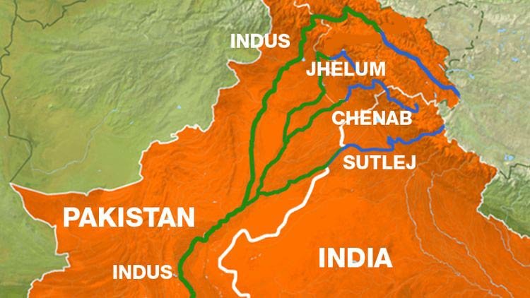
The Indus River Basin is the largest and most vital basin in Pakistan, covering nearly two-thirds of the country’s area. Originating from the Tibetan Plateau near Lake Manasarovar, the Indus flows through Gilgit-Baltistan, Khyber Pakhtunkhwa, Punjab, and Sindh before entering the Arabian Sea near Thatta. Its major tributaries — Jhelum, Chenab, Ravi, Sutlej, Kabul, and Swat — form a vast network that irrigates millions of hectares of farmland. The basin supports the world’s largest contiguous irrigation system, the Indus Basin Irrigation System, managed by the Indus River System Authority (IRSA).
Arabian Sea Basin
Beyond the Indus system, several smaller rivers in Balochistan flow directly into the Arabian Sea. These include the Hingol, Dasht, and Basol rivers, which are primarily rain-fed and seasonal. Despite their short length, these rivers are crucial for sustaining coastal ecosystems and communities in the Makran region.
Coastal and Inland Drainage
In southern and western Pakistan, arid climates create endorheic or closed basins where rivers do not reach the sea. The Hamun-e-Mashkel basin in Balochistan and seasonal streams in Kharan and Makran regions are key examples. These inland drainage systems contribute to groundwater recharge and local agriculture, especially after monsoon rains.
Major Rivers of Pakistan and Their Location
The following are the major rivers of Pakistan, described by their origin, route, and the regions they pass through.
Indus River
The Indus River, stretching about 3,180 kilometers, is Pakistan’s longest and most important river. It originates near Lake Manasarovar in Tibet and enters Pakistan through Gilgit-Baltistan, flowing south across Khyber Pakhtunkhwa, Punjab, and Sindh before emptying into the Arabian Sea. The river sustains more than 200 million people and serves as the backbone of Pakistan’s economy. For hydrological data and flow maps, visit UNESCO’s Indus River overview.
Jhelum River
The Jhelum River rises from Verinag Spring in Indian-administered Kashmir. It flows northwest to Wular Lake, then southward into Pakistan, where it passes through Mangla — home to the Mangla Dam — before merging with the Chenab River near Trimmu. The dam, managed by WAPDA, is one of Pakistan’s key water storage and energy generation sites.
Chenab River
Formed by the confluence of the Chandra and Bhaga rivers in Himachal Pradesh, India, the Chenab enters Pakistan near Sialkot. It flows through Punjab, passing the cities of Gujrat and Multan, before merging with the Indus River near Mithankot. Its fertile floodplains are among Pakistan’s most productive agricultural regions.
Ravi River
The Ravi River originates from the Himalayas near Chamba, India, and enters Pakistan near Lahore. It runs along the international border and merges with the Chenab River south of Ahmedpur. Although smaller in volume, it has deep cultural significance and supports agriculture in central Punjab.
Sutlej River
The Sutlej originates from Lake Rakshastal in Tibet, flowing southwest through Himachal Pradesh and entering Pakistan near Kasur. It joins the Chenab River at Panjnad before converging into the Indus. Under the Indus Water Treaty (1960), the Sutlej’s waters are allocated to India, though it continues to play an ecological role in southern Punjab.
Kabul River
The Kabul River rises from the Hindu Kush Mountains in Afghanistan, entering Pakistan near Torkham and joining the Indus at Attock. Major towns along its course include Nowshera and Peshawar. The Warsak Dam on this river provides hydropower and irrigation to Khyber Pakhtunkhwa.
Swat, Gilgit, and Other Tributaries
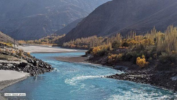
The Swat River originates from the Ushu Valley and joins the Kabul River near Charsadda. The Gilgit River, along with the Shyok, Hunza, and Shigar rivers, feeds the upper Indus Basin from glaciers in the Karakoram and Himalayas. These tributaries are essential for sustaining glacial melt inflows that account for nearly 70% of Pakistan’s river water supply.
Rivers by Province and Region
Understanding rivers by province helps clarify their economic, cultural, and ecological roles across Pakistan’s diverse landscapes.
Rivers in Punjab
Punjab, meaning “Land of Five Rivers,” is home to the Jhelum, Chenab, Ravi, Sutlej, and Beas rivers. All five converge at Panjnad before merging with the Indus River. The province’s extensive canal system, managed by the Punjab Irrigation Department, relies on these rivers for irrigation and drinking water.
Rivers in Sindh
The Sindh province is defined by the lower Indus River, which meanders through vast plains before forming the Indus Delta. The delta’s wetlands support fisheries, mangroves, and biodiversity. Seasonal rivers like Hab and Malir supplement the Indus during monsoon months.
Rivers in Khyber Pakhtunkhwa (KPK)
KPK hosts mountain-fed rivers such as the Kabul, Swat, Tochi, and Kurram. These rivers are crucial for hydropower development and tourism, particularly in Swat and Dir valleys. Small tributaries contribute to the Indus River at different junctions along the province.
Rivers in Balochistan
Balochistan’s rivers differ from the snow-fed systems of the north. They are mostly seasonal and depend on monsoon rains. Key rivers include the Hingol, Dasht, Zhob, Nari, and Porali. The Hingol River flows through Hingol National Park before reaching the Arabian Sea, forming spectacular gorges and wetlands. The Nari and Zhob rivers, on the other hand, support agriculture through traditional flood irrigation systems in central Balochistan. Although these rivers are small, they play an outsized role in sustaining life in Pakistan’s driest province.
Rivers in Gilgit-Baltistan
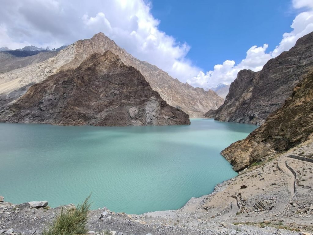
In Gilgit-Baltistan, rivers originate from some of the world’s highest peaks and largest glaciers. The Gilgit, Hunza, Shigar, and Shyok rivers all contribute to the Upper Indus Basin. These rivers are crucial for hydropower and glacier melt studies. Nearly 80% of the Indus River’s total volume originates here from snow and glacier runoff, making this region a hydrological powerhouse. Seasonal variations in glacial melt directly influence irrigation and energy production across the country.
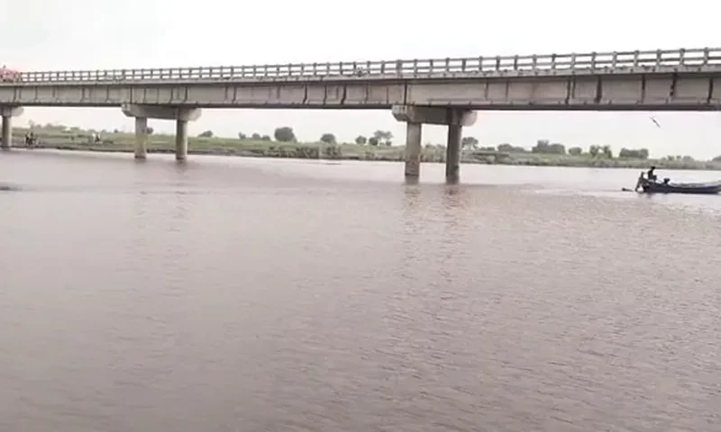
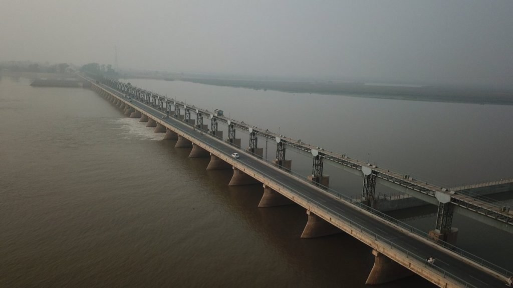
Hydropower and Irrigation Infrastructure on Pakistan’s Rivers
Pakistan’s rivers are harnessed for both energy and agriculture through an extensive network of dams, barrages, and canals. The Water and Power Development Authority (WAPDA) manages most of these infrastructures, ensuring equitable distribution across provinces under the Indus Water Accord.
Tarbela Dam on the Indus River
The Tarbela Dam in Khyber Pakhtunkhwa is one of the largest earth-filled dams in the world. It was completed in 1976 and provides water storage capacity of 11.1 billion cubic meters. Tarbela generates thousands of megawatts of electricity and plays a vital role in controlling floods along the Indus. Its reservoir also supports local fisheries and recreation.
Mangla Barrage on the Jhelum River
Constructed in 1967, the Mangla Barrage regulates water for central Punjab’s agricultural zones. Its reservoir, one of the largest in Asia, supplies irrigation water, supports hydropower generation, and helps maintain ecological balance in the Jhelum basin. The dam is part of Pakistan’s strategy under the Indus Water Treaty to maximize the use of western rivers.
Panjnad Barrage and Canal Network
The Panjnad Barrage in southern Punjab marks the confluence of the five Punjab rivers. It regulates water flow into canals that irrigate the Bahawalpur and Rahim Yar Khan districts. The barrage’s design helps manage floodwaters and sustains one of Pakistan’s richest agricultural belts.
Environmental and Cultural Importance of Rivers in Pakistan
Pakistan’s rivers have shaped ecosystems and civilizations for millennia. Today, they face the twin challenges of environmental stress and overuse, yet remain central to the country’s identity and survival.
Ecological and Economic Role
Rivers sustain Pakistan’s fisheries, wetlands, and agriculture. The Indus Delta alone provides habitat for over 200 species of fish and supports thousands of livelihoods. However, pollution, reduced freshwater inflows, and upstream diversions have led to declining river health. Climate change also threatens glacial sources, altering flow patterns. Organizations like WWF Pakistan are working to restore river ecosystems through sustainable water management and biodiversity conservation programs.
Cultural and Historical Significance
The rivers of Pakistan are deeply intertwined with the region’s history. The Indus Valley Civilization, one of the world’s earliest urban cultures, flourished along the banks of the Indus around 2500 BCE. Many cities — including Harappa, Mohenjo-daro, and Sukkur — owe their existence to these rivers. Even today, rivers inspire poetry, music, and folklore, symbolizing continuity and resilience in Pakistani culture.
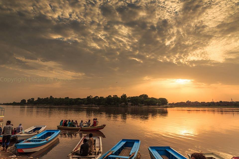
Tourism and Recreation Along Pakistan’s Rivers
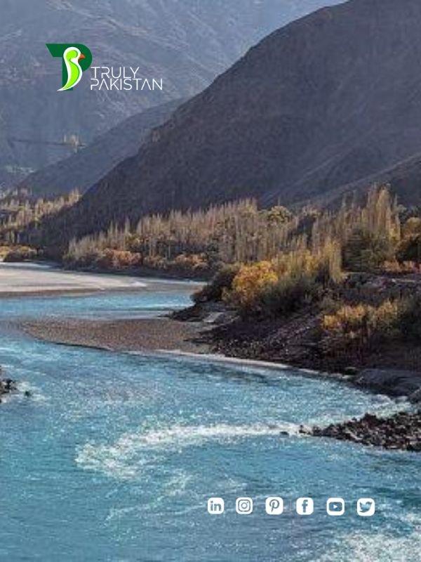
Rivers also shape Pakistan’s tourism landscape. In northern Pakistan, the Indus and its tributaries carve dramatic valleys, attracting trekkers, anglers, and photographers. The Swat River is popular for rafting and fishing, while the Attock and Gilgit regions offer scenic viewpoints of the Indus Gorge. In Sindh, the Indus Delta provides eco-tourism opportunities through mangrove exploration and birdwatching. The Pakistan Tourism Development Corporation (PTDC) encourages river-based tourism to promote local economies and environmental awareness.
Frequently Asked Questions (FAQ)
What Are the Major Rivers of Pakistan and Their Location?
Pakistan’s five major rivers are the Indus, Jhelum, Chenab, Ravi, and Sutlej. All flow generally southward, merging near Panjnad in Punjab before joining the Indus River, which empties into the Arabian Sea near Karachi.
Where Does the Indus River Originate and End?
The Indus originates near Lake Manasarovar in Tibet and ends at the Indus Delta in Sindh, where it flows into the Arabian Sea. Its total length is about 3,180 kilometers.
Which River Is Known as the Lifeline of Pakistan?
The Indus River is often called the lifeline of Pakistan because it supplies more than 80% of the country’s irrigation and freshwater needs, supporting both agriculture and hydropower.
How Many Rivers Flow in Punjab Pakistan?
Punjab has five main rivers — Jhelum, Chenab, Ravi, Sutlej, and Beas — which give the province its name (“Land of Five Rivers”). They converge at Panjnad before meeting the Indus River.
What Are the Major Tributaries of the Indus River?
The Indus River’s major tributaries include the Kabul, Swat, Gilgit, Shigar, Hunza, Shyok, Jhelum, Chenab, Ravi, and Sutlej rivers. These tributaries originate from glaciers and high-altitude springs, contributing to the river’s year-round flow.
Comparative Overview and Additional Insights
Pakistan’s rivers differ not only in geography but also in the scale of their contribution to agriculture, energy, and biodiversity. Understanding these differences highlights the regional diversity and the shared interdependence built around water.
Comparison of Major Rivers of Pakistan and Their Location
| River | Source | Flows Through | Joins / Ends | Key Features |
|---|---|---|---|---|
| Indus | Lake Manasarovar, Tibet | GB, KPK, Punjab, Sindh | Arabian Sea (Indus Delta) | Main river of Pakistan; Tarbela Dam |
| Jhelum | Verinag Spring, Kashmir | AJK, Punjab | Joins Chenab near Trimmu | Mangla Dam; key for irrigation |
| Chenab | Himalayas, Himachal Pradesh | Punjab | Joins Indus near Mithankot | Fertile plains; major canal system |
| Ravi | Chamba, India | Punjab (Lahore region) | Joins Chenab | Smaller but culturally significant |
| Sutlej | Lake Rakshastal, Tibet | Punjab (Kasur region) | Joins Chenab at Panjnad | Southernmost river; under Indus Treaty |
| Kabul | Hindu Kush Mountains | KPK | Joins Indus at Attock | Hydropower and cross-border significance |
This table provides a concise snapshot of the rivers’ geography and their contribution to Pakistan’s hydrological network. Such data-driven comparison helps students, researchers, and travelers understand the national water system at a glance.
Conclusion: Understanding Pakistan’s Lifelines
The rivers of Pakistan and their location reveal a country deeply shaped by water — from the snow-capped Himalayas to the fertile plains of Punjab and the vast Indus Delta. These rivers have sustained civilizations, powered industries, and nurtured cultures for thousands of years. Yet today, they face modern challenges that demand collective responsibility and sustainable management.
Preserving these waterways means securing Pakistan’s food, energy, and environmental future. Stronger policies, smarter water management, and public awareness can help protect these rivers for generations to come. Whether viewed from the perspective of geography, ecology, or culture, Pakistan’s rivers remain the nation’s lifelines — flowing symbols of connection, resilience, and renewal.
Related Post: River Tourism in Pakistan: Exploring Untapped Waterways for Sustainable Travel

Author: ZunNurain Khalid — Travel & Tourism Specialist, Founder of ExploreX Pvt. Ltd., and advocate for sustainable tourism in Pakistan. With over a decade of experience in digital marketing and destination branding, ZunNurain has worked extensively on promoting Pakistan’s natural and cultural heritage.
References
- Wikipedia: List of Rivers of Pakistan
- Water and Power Development Authority (WAPDA)
- Indus River System Authority (IRSA)
- Indus Water Treaty, 1960
- WWF Pakistan – River Conservation Programs
- Pakistan Tourism Development Corporation (PTDC)
- Punjab Irrigation Department
- National Coordination Committee (NCC): Important Rivers of Pakistan PDF
- UNESCO Water Security and Hydrology Data
Last reviewed: October 2025
Disclaimer: Information provided is based on verified data from government, academic, and conservation sources. All coordinates and flow details are approximate and may vary seasonally.
One thought on “Rivers of Pakistan and Their Location: Complete Guide”