On its eastern side, Azad Kashmir is separated from the Indian union territory of Jammu and Kashmir (part of Indian-administered Kashmir) by the Line of Control (LoC), which serves as the de facto border between the Indian- and Pakistani-controlled parts of Kashmir. Geographically, the administrative territory of Azad Jammu and Kashmir (which excludes Gilgit-Baltistan) covers a total area of 13,297 km2 (5,134 sq mi) and has a total population of 4,045,366 as per the 2017 national census.
The territory has a parliamentary form of government modeled after the British Westminster system, with the city of Muzaffarabad serving as its capital. The President of AJK is the constitutional head of state, while the Prime Minister, supported by a Council of Ministers, is the chief executive. The unicameral Azad Kashmir Legislative Assembly elects both the Prime Minister and President. The territory has its own Supreme Court and a High Court, while the Government of Pakistan’s Ministry of Kashmir Affairs and Gilgit-Baltistan serves as a link between itself and Azad Jammu and Kashmir’s government, although the autonomous territory is not represented in the Parliament of Pakistan.
Northern Azad Kashmir lies in a region that experiences strong vibrations of the earth as a result of the Indian plate underthrusting the Eurasian plate.[14] A major earthquake in 2005 killed at least 100,000 people and left another three million people displaced, causing widespread devastation to the region’s infrastructure and economy. Since then, with help from the Government of Pakistan and foreign aid, reconstruction of infrastructure is underway. Azad Kashmir’s economy largely depends on agriculture, services, tourism, and remittances sent by members of the British Mirpuri community. Nearly 87% of Azad Kashmiri households own farm property, and the region has the highest rate of school enrolment in Pakistan and a literacy rate of approximately 72%.
Climate
The southern parts of Azad Kashmir, including the Bhimber, Mirpur, and Kotli districts, have extremely hot weather in the summer and moderate cold weather in the winter. They receive rain mostly in monsoon weather.[citation needed]
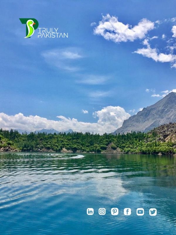
Paddy field in Leepa valley
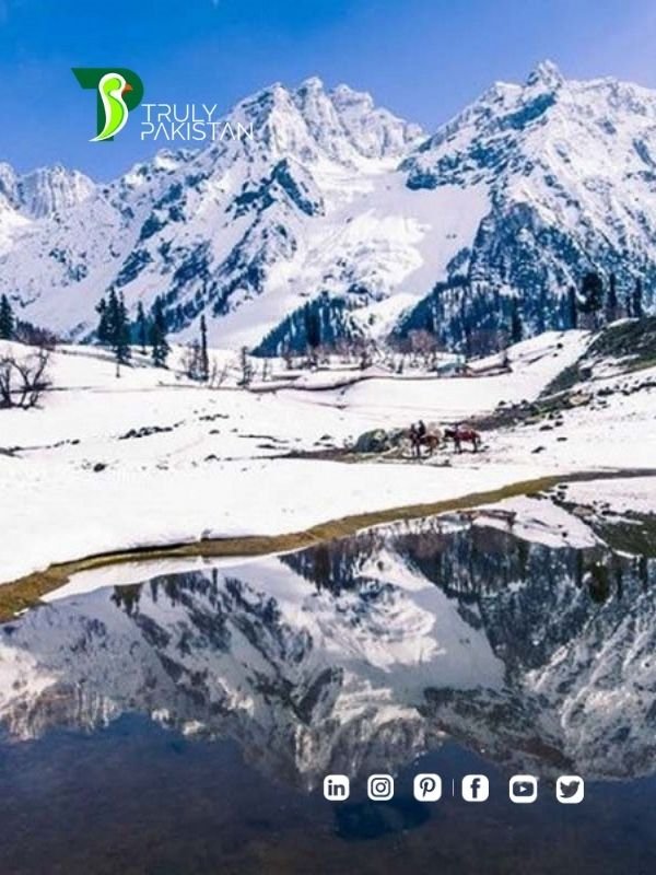
In the central and northern parts of the state, the weather remains moderately hot in the summer and cold and chilly in the winter. Snowfall also occurs there in December and January.
The region receives rainfall in both the winter and the summer. Muzaffarabad and Pattan are among the wettest areas of the state, but they don’t receive snow. Throughout most of the region, the average rainfall exceeds 1400 mm, with the highest average rainfall occurring near Muzaffarabad (around 1800 mm). During summer, monsoon floods of the Jhelum and Leepa rivers are common, due to high rainfall and melting snow.
Population
The population of Azad Kashmir, according to the preliminary results of the 2017 Census, is 4.045 million. The website of the AJK government reports the literacy rate to be 74%, with the enrolment rate in primary school being 98% and 90% for boys and girls respectively.
The population of Azad Kashmir is almost entirely Muslim. The people of this region culturally differ from the Kashmiris living in the Kashmir Valley of Jammu and Kashmir and are closer to the culture of Jammu. Mirpur, Kotli, and Bhimber are all old towns of the Jammu region.
Religion
Azad Jammu and Kashmir have an almost entirely Muslim population. According to data maintained by Christian community organizations, there are around 4,500 Christian residents in the region. Bhimber is home to most of them, followed by Mirpur and Muzaffarabad. A few dozen families also live in Kotli, Poonch, and Bagh. However, the Christian community has been struggling to get residential status and property rights in AJK. There is no official data on the total number of Bahais in AJK. Only six Bahai families are known to be living in Muzaffarabad with others living in rural areas. The followers of the Ahmadi faith are estimated to be somewhere between 20,000 and 25,000, and most of them live in Kotli, Mirpur, Bhimber, and Muzaffarabad.
Major Tourist destinations
- Muzaffarabad, the capital city of Azad Kashmir, is located on the banks of the Jhelum and Neelum rivers. It is 138 km (86 mi) from Rawalpindi and Islamabad. Well-known tourist spots near Muzaffarabad are the Red Fort, Pir Chinassi, Patika, Subri Lake and Awan Patti.
- The Neelam Valley is situated to the north and northeast of Muzaffarabad, The gateway to the valley. The main tourist attractions in the valley are Athmuqam, Kutton, Keran, Changan, Sharda, Kel, Arang Kel and Taobat.
- Sudhanoti is one of the eight districts of Azad Kashmir in Pakistan. Sudhanoti is located 90 km (56 mi) away from Islamabad, the Capital of Pakistan. It is connected with Rawalpindi and Islamabad through Azad Pattan road.
- Rawalakot city is the headquarters of Poonch District and is located 122 km (76 mi) from Islamabad. Tourist attractions in Poonch District are Banjosa Lake, Devi Gali, Tatta Pani, and Toli Pir.
- Bagh city, the headquarters of Bagh District, is 205 km (127 mi) from Islamabad and 100 km (62 mi) from Muzaffarabad. The principal tourist attractions in Bagh District are Bagh Fort, Dhirkot, Sudhan Gali, Ganga Lake, Ganga Choti, Kotla Waterfall, Neela Butt, Danna, Panjal Mastan National Park, and Las Danna.
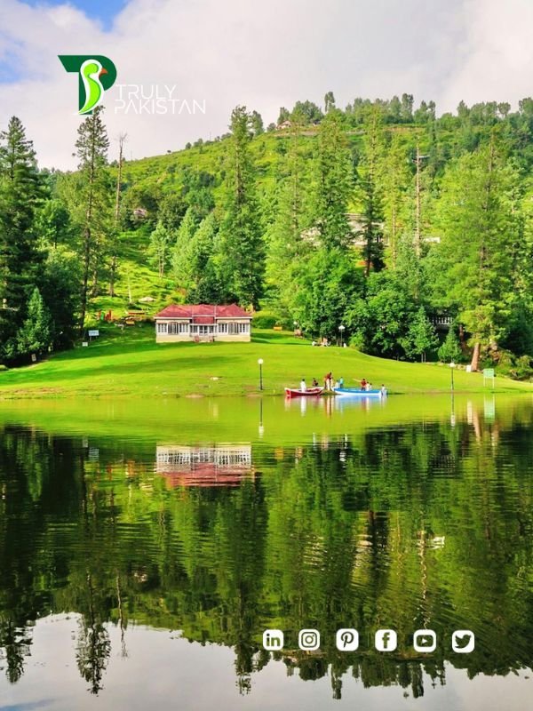
- The Leepa Valley is located 105 km (65 mi) southeast of Muzaffarabad. It is the most charming and scenic place for tourists in Azad Kashmir.
New Mirpur City is the headquarters of Mirpur District. The main tourist attractions near New Mirpur City are the Mangla Lake and Ramkot Fort.
Education
The literacy rate in Azad Kashmir was 62% in 2004, higher than in any other region of Pakistan. The current literacy rate of Azad Kashmir is 76.60% in 2018. And it remained at 79.80% in 2019. According to the 2020–2021 census, the literacy rate in Azad Kashmir was 91.34% However, only 2.2% were graduates, compared to the average of 2.9% for Pakistan.