Khunjerab Sar I: Complete Climbing and Travel Guide
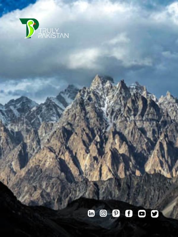
Khunjerab Sar I is a little-documented six-thousander in Pakistan’s Karakoram, frequently confused online with nearby Yawash Sar I. This guide clarifies the name, location, and context, then builds a reliable foundation for planning—using verifiable, authoritative sources at every step.
Table of Contents
Khunjerab Sar I Overview and Location
Elevation and coordinates for khunjerab sar i
Multiple community-sourced listings place khunjerab sar i a little above 6,000 m (≈6,020–6,030 m) with coordinates in the Khunjerab/Khunjerab National Park region. Because these entries are not official survey records, treat them as indicative rather than definitive. See the map label on Yandex Maps (community listing) and compare with regional expedition reports from the American Alpine Journal archives for ground-truth context. Range / Region Karakoram, Gilgit-Baltistan, Pakistan Nearest transport axis Karakoram Highway (KKH) via Sost/Khunjerab Pass Protected area Within/adjacent to Khunjerab National Park — special care for wildlife & Leave No Trace Documentation status Sparse; corroborate plans with AAJ regional reports and licensed local operators
Khunjerab Sar I vs. Yawash Sar I: why the distinction matters
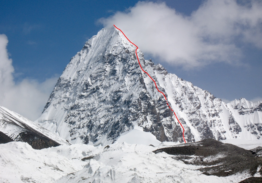
Online content often blends these two peaks. Yawash Sar I (6,258 m)—a separate summit—was climbed in September 2024 by Mick Fowler and Victor Saunders via the NW/WNW side, documented by reputable alpine news outlets. For verified first-ascent details, see the reports from PlanetMountain (first ascent report) and ExplorersWeb (expedition coverage). Distinguishing Yawash Sar I from khunjerab sar i prevents route and logistics errors.
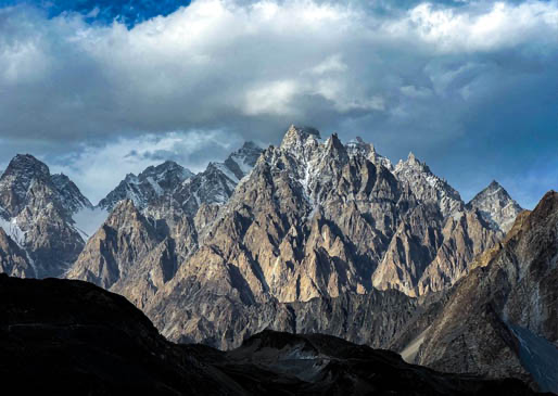
Khunjerab Sar I in the Karakoram & National Park setting
The peak sits near the high plateau around Khunjerab Pass—an area of glaciers, rolling high valleys (e.g., Koksil systems), and strict environmental sensitivities. For the protected-area context and species conservation guidelines, consult the overview of Khunjerab National Park. For approach styles and historical climbs in adjacent valleys (useful analogs), browse the AAJ: Fifth Koksil Glacier & Chapchingol Sar and related Karakoram notes in the AAJ archive.
Planning Your Khunjerab Sar I Expedition
Permits, rules, and notifications for khunjerab sar i
Pakistan’s mountaineering framework distinguishes peaks by height and zone. Historically, many sub-6,500 m objectives in open areas have not required the same full permit process as 7,000–8,000 m peaks, yet registration, local clearances, border sensitivities, proof of insurance, and liaison requirements can still apply. Always verify with current guidance from the Alpine Club of Pakistan (ACP) and Gilgit-Baltistan authorities; tour-operator summaries (e.g., Saltoro Summits: Mountaineering Rules) are useful primers but official positions prevail.
- Confirm status (area, peak list, any restricted zones) with ACP/GB office in writing.
- Carry expedition insurance acceptable to Pakistani authorities.
- Follow Khunjerab National Park’s conservation regulations and checkpoints.
Best season & operational realities
Like much of the Karakoram, the pragmatic window is July to September when passes and high valleys are most workable and the Karakoram Highway is typically operational. Monitor regional forecasts with the Pakistan Meteorological Department and factor in KKH closures or park advisories before committing dates.
Getting to Khunjerab Sar I Base Camp
Travel logistics from Islamabad to Hunza
Most expeditions begin in Islamabad, Pakistan’s capital. Teams usually take a short domestic flight to Gilgit (weather permitting) or opt for a two-day drive on the legendary Karakoram Highway. From Gilgit, travel continues north into Hunza Valley, with Sost serving as the last major town and resupply point before the Chinese border.
Access via the Karakoram Highway and Sost
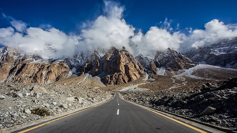
Sost lies roughly 85 km from Khunjerab Pass and is the final checkpoint on the KKH. Expeditions can arrange 4×4 transport from Sost to trailheads near the Koksil system. Ensure all documents are ready for inspection at border security points. For background on the high-altitude road environment, see DangerousRoads: Khunjerab Pass.
Koksil Valley approach to base camp
The Koksil Valleys contain several glaciers (notably the 4th and 5th Koksil), which have served as access corridors for nearby peaks like Chapchingol Sar. Basecamp locations vary, but the American Alpine Journal report on the Fifth Koksil Glacier provides practical descriptions of terrain, campsites, and challenges. This historical material is valuable when planning logistics for Khunjerab Sar I.
Climbing Routes and Technical Notes on Khunjerab Sar I
Northwest Face and neighboring examples
While Khunjerab Sar I has not been extensively documented, nearby Yawash Sar I was first climbed in September 2024 via its NW/WNW face. That alpine-style ascent, reported in ExplorersWeb, demonstrates the steep snow and mixed terrain characteristic of this cluster of peaks. Expect similar glacial approaches, serac hazards, and mixed snow/ice sections.
Alternative approaches via Koksil glaciers
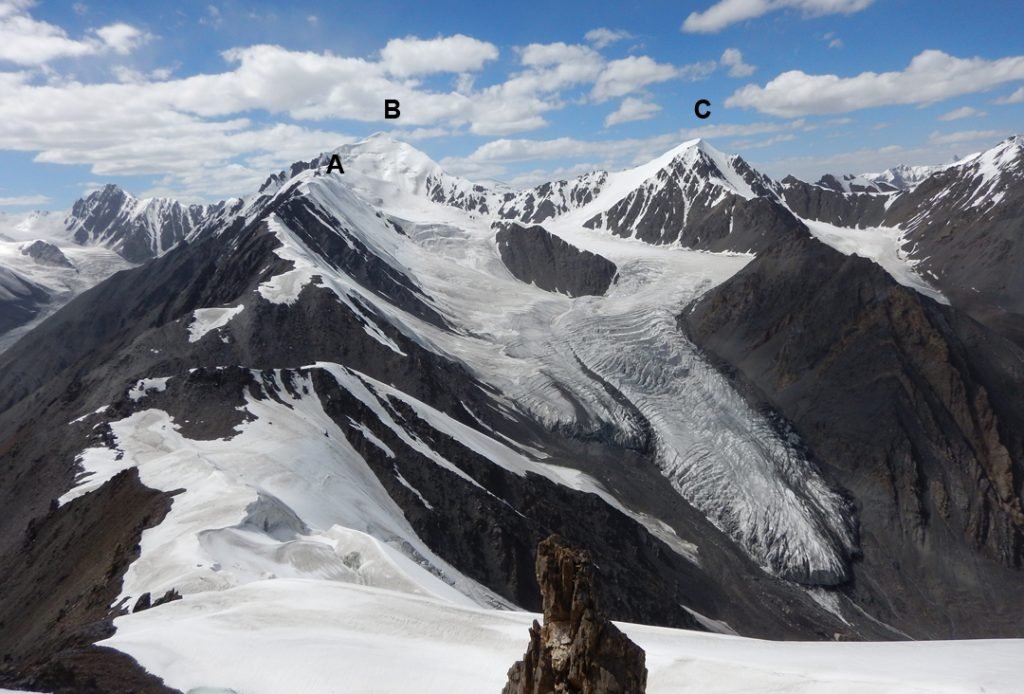
The Koksil glacier network offers potential alternative lines. Past expeditions on Chapchingol Sar and Koksil Sar show that moderate technical ridges alternate with broken icefall zones. See the AAJ report on Koksil Sar for terrain parallels useful in risk assessment.
Difficulty level and technical skills required
At over 6,000 m in the Karakoram, climbers should anticipate:
- Alpine skills for crevasse rescue and steep snow slopes.
- Competence with ice protection, fixed rope setup, and multi-day high-altitude bivouacs.
- Acclimatization schedules to manage altitude stress at basecamp and higher camps.
This makes khunjerab sar i a serious undertaking—best for experienced alpinists with prior Pakistan or Himalaya exposure.
Essential Equipment and Gear Checklist for Khunjerab Sar I
Mountaineering gear essentials
- Double boots rated for 6000 m+ peaks
- Technical ice axes and crampons
- Dynamic climbing ropes and protection (screws, pickets)
- Four-season tents and high-R-value sleeping systems
Clothing for Karakoram conditions
A robust layering system is critical:
- Moisture-wicking base layers
- Insulating mid-layers (down or synthetic)
- Waterproof and windproof outer shells
- Expedition-weight gloves, mitts, and balaclavas
Where to source gear in Pakistan
Most foreign expeditions bring the majority of their gear, but supplementary items can be rented or purchased in Islamabad and Skardu. For reference on high-quality gear lists, browse the Mountain Equipment Co-op gear checklist and cross-check with your outfitter in Pakistan.
Safety, Risks, and Environmental Considerations
Common hazards on khunjerab sar i
Climbers can expect the full spectrum of Karakoram risks. These include:
- Avalanches triggered by unstable snowpack or cornice collapse.
- Altitude illness (AMS, HAPE, HACE) due to rapid ascent above 5,000 m.
- Crevasse falls on broken glacier approaches in the Koksil valleys.
- Severe weather shifts, common in the Karakoram, with storms rolling in rapidly.
Preparation means more than gear—teams must have rehearsed crevasse rescue, first-aid, and high-altitude decision-making before attempting khunjerab sar i.
Emergency protocols and evacuation
Evacuation options are limited. Helicopter rescue is coordinated through Pakistan authorities and requires insurance accepted by the Alpine Club of Pakistan. Ground evacuations via the Karakoram Highway can be long and delayed by weather or landslides. Teams should carry satellite communication (InReach, Thuraya, Iridium) and pre-plan emergency contacts.
Conservation inside Khunjerab National Park
Because khunjerab sar i lies within the bounds of Khunjerab National Park, climbers must follow strict conservation rules:
- All trash and non-biodegradable waste must be carried out.
- No disturbance of local wildlife (snow leopards, Marco Polo sheep).
- Minimal impact camping—use existing sites where possible.
Respecting these regulations ensures future access and helps preserve one of Pakistan’s most sensitive high-altitude ecosystems.
Cultural Context and Local Communities
Wakhi culture and borderland heritage
The Wakhi-speaking communities of upper Hunza and Khunjerab valleys have lived here for centuries, relying on pastoral traditions and cross-border trade routes. Visitors should respect cultural sensitivities, ask before photographing, and show appreciation for local hospitality.
Supporting local economies
Hiring local guides, cooks, and porters not only improves safety but also ensures your expedition contributes to the livelihood of people in Sost and nearby villages. Tour operators such as North Pakistan Adventure emphasize this principle of responsible tourism.
Respecting local customs
Simple gestures matter: modest dress in villages, avoiding litter at sacred sites, and engaging respectfully with elders. These small practices build goodwill and smooth expedition logistics in the border zone.
FAQ on Khunjerab Sar I
What is the elevation of khunjerab sar i?
Community and expedition reports place the peak around 6,020–6,030 m, though it remains less formally surveyed than nearby summits like Yawash Sar I at 6,258 m (ExplorersWeb source).
How difficult is climbing khunjerab sar i?
Given the Karakoram environment, climbers should expect glacial travel, steep snow, and possible mixed climbing. It is not suitable for beginners.
Do you need a permit to climb khunjerab sar i?
Peaks under 6,500 m often do not require the same full permits as 7,000–8,000 m summits, but you must register and coordinate with the relevant authorities. Insurance and liaison officer requirements may apply.
What is the best time to climb khunjerab sar i?
The practical climbing window is July–September, when access roads are clear and weather is relatively stable (Pakistan Meteorological Department seasonal guidance).
How long does it take to climb khunjerab sar i?
Most expeditions require 10–14 days on site, including acclimatization, weather holds, and summit attempts. Travel from Islamabad to Sost/Basecamp adds another 3–5 days.
Conclusion: Why Khunjerab Sar I Deserves Your Attention
Khunjerab Sar I remains one of the least-documented 6000 m peaks in Pakistan’s Karakoram, yet its proximity to the Karakoram Highway and location inside Khunjerab National Park make it uniquely accessible. Distinguishing it from the more publicized Yawash Sar I is essential for safe planning. With careful logistics, respect for conservation, and support for local communities, Khunjerab Sar I represents both a mountaineering challenge and a cultural encounter at the roof of Pakistan.
Read More About: Lalazar Meadows: Complete Travel Guide

Author: ZunNurain Khalid — Travel & Tourism Specialist, Founder of ExploreX Pvt. Ltd., and advocate for sustainable tourism in Pakistan. With over a decade of experience in digital marketing and destination branding, ZunNurain has worked extensively on promoting Pakistan’s natural and cultural heritage.
References
- American Alpine Journal: Fifth Koksil Glacier & Chapchingol Sar
- PlanetMountain: First Ascent of Yawash Sar I
- ExplorersWeb: Fowler & Saunders Alpine Style First Ascent
- Saltoro Summits: Mountaineering Rules in Pakistan
- Pakistan Meteorological Department
- Khunjerab National Park Overview
- Dangerous Roads: Khunjerab Pass
- Karakoram Highway Travel Guide
- MEC Gear Lists
One thought on “Khunjerab Sar I Pakistan – Complete Climbing Guide”