Everything You Need to Know Before You Go
In January 2025, CNN Travel named Gilgit-Baltistan one of the top 25 destinations to visit in 2025. Their exact words: ‘more tantalising peaks than a lemon meringue pie.’ They also noted that hiking here ‘makes the Himalayas look like a traipse in Central Park.’ 2,380 foreign climbers and trekkers visited in 2024 — up from 2,100 the year before.
Gilgit-Baltistan is a territory the size of Austria sitting in Pakistan’s far north — the point where three of the world’s great mountain ranges collide. The Karakoram, the Hindu Kush, and the Himalayas don’t just meet here. They pile up on top of each other into a concentration of extreme altitude that has no equal anywhere on Earth.
Five of the world’s fourteen peaks above 8,000 meters are here. More than fifty peaks above 7,000 meters. Three of the world’s longest glaciers outside the polar regions. A desert that gets snow in winter and flowers in July. A plateau at over 13,000 feet that is the only stable home of the Himalayan brown bear in the entire range. And the Karakoram Highway running through the middle of all of it — the highest paved international road on Earth.
This guide covers the whole region: the two main hubs (Gilgit and Skardu), the key destinations, how to get here from the US, what to do, when to go, and what nobody tells first-time visitors until they’re already on the plane.
Gilgit-Baltistan — At a Glance
| Category | Details |
|---|---|
| Size | 27,188 sq miles / 72,000 sq km — approximately the size of Austria |
| Status | Autonomous territory of Pakistan — not a province |
| Population | ~1.5 million (one of Pakistan’s least densely populated regions) |
| Major towns | Gilgit (administrative capital) · Skardu (southern hub) · Karimabad (Hunza) |
| 8,000-meter peaks | 5 — K2, Nanga Parbat, Gasherbrum I, Broad Peak, Gasherbrum II |
| Glaciers | 3 of world’s longest non-polar: Baltoro (39 mi), Biafo, Batura |
| Highest paved road | Khunjerab Pass — 4,693 m / 15,397 ft (Pakistan-China border) |
| Highest plateau | Deosai — 4,114 m average, second-highest plateau in the world |
| Wildlife | Himalayan brown bear · Snow leopard · Siberian ibex · Himalayan wolf |
| Languages | Shina · Burushaski · Balti · Urdu · English in tourist areas |
| Domestic flights | Islamabad–Gilgit (~1 hr) · Islamabad–Skardu (~1 hr) · PIA + Serene Air |
| Best season | May–October overall · June 15–August 15 for high-altitude trekking |
| Safety | No Level 4 US State Dept advisory · Strong trekking safety record · Full safety guide |
| CNN recognition | Named top 25 must-visit destinations for 2025 |
Understanding GB: Two Hubs, One Region
Most visitors make a critical planning mistake: they book a flight to Islamabad and assume they’ll ‘figure out Gilgit-Baltistan‘ once they arrive. The region is large enough and varied enough that a week spent without a clear base will leave you feeling you saw a fraction of what’s here. Start with the two hubs.
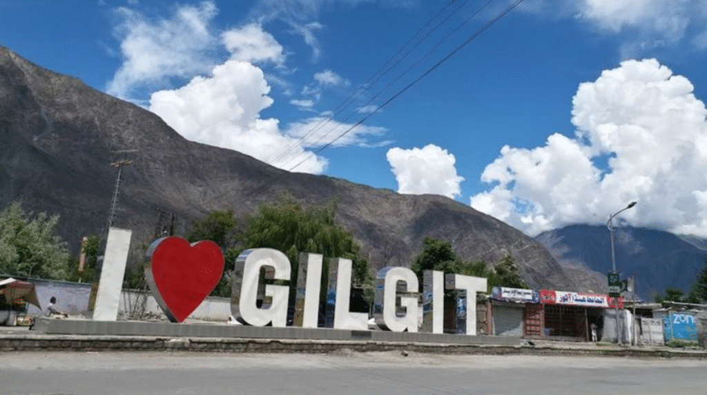
Gilgit — The Northern Gateway
Gilgit is the administrative capital and the northern anchor of the Karakoram Highway. It sits at 1,500 meters at the confluence of the Gilgit, Hunza, and Ghizer rivers — a natural crossroads that has been a trading junction since the Silk Road era.
Most travelers pass through Gilgit rather than stay — flying in to connect to Hunza (2 hours north by car) or catching onward transport to other destinations. But Gilgit earns at least a day on its own: the Kargah Buddha, carved into a cliff face in the 7th century, is a 45-minute drive from town. The bazaar is the most functional and least touristy market in the region. And the city’s position at the mountain crossroads means the views from any high ground are extraordinary.
Getting there: 1-hour domestic flight from Islamabad (PIA / Serene Air) — book early
Altitude: 1,500 m / 4,921 ft — comfortable for acclimatization before going higher
Connections: 2 hrs to Hunza (north) · 4 hrs to Skardu (east on KKH) · 3 hrs to Fairy Meadows
Stay: 1 night is sufficient as a base before moving to destinations
Don’t miss: Kargah Buddha (7th century cliff carving, 45 min drive) · Gilgit bazaar
Skardu — The Southern Hub and K2 Gateway
Skardu is a different kind of place. Where Gilgit feels like a working mountain town, Skardu feels like a base camp for the planet’s most extreme mountains. The Indus River runs through it. The Karakoram peaks surround it. And the airport sits at 2,230 meters — one of the world’s highest commercial airports — with approaches so dramatic that pilots need special certification to fly the route.
Skardu is the jump-off point for K2 expeditions, the Baltoro Glacier, Broad Peak, and the Gasherbrums. But beyond the mountaineering infrastructure, the town has earned its own attractions: Kharpocho Fort sits on a massive rock above the city and offers a panorama of the Indus Valley that is difficult to overstate. Katpana Cold Desert — sand dunes against a backdrop of snow-capped peaks — is one of the most improbable landscapes in Pakistan. Shangrila Lake, 35 km away, was made famous by a 1930s explorer who called it the closest thing to Shangri-La he’d ever found.
Getting there: 1-hour domestic flight from Islamabad · Book early — weather cancellations are common
Altitude: 2,230 m / 7,316 ft — allow 1 night acclimatization before heading higher
Best base for: K2 Base Camp trek, Deosai Plateau, Shigar Valley, Khaplu Valley
Don’t miss: Kharpocho Fort · Katpana Cold Desert · Shangrila Lake · K2 Museum (Italian-funded)
Backup plan: If flight is cancelled, Skardu is 15–18 hours by road from Islamabad via KKH + Indus Highway
The Key Destinations — What’s Worth Your Time
Gilgit-Baltistan has more destinations than any two-week trip can cover. What follows are the ones that consistently deliver — ranked by what they offer and what they require.
| Destination | Hub | Difficulty | Why It Earns the Trip |
|---|---|---|---|
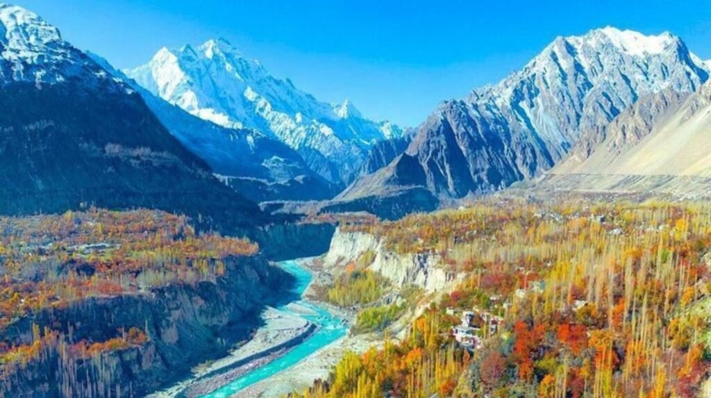
| Hunza Valley | Gilgit | Easy–Moderate | The benchmark. 1,100-year-old forts, Attabad Lake, Eagle’s Nest, extraordinary hospitality. Base: Karimabad. |
| Attabad Lake | Gilgit | Easy | Turquoise glacier lake in a canyon. Formed by landslide in 2010. Boating, Passu Cones backdrop. 1 hr from Karimabad. |
| Khunjerab Pass | Gilgit | Easy | World’s highest paved international border at 4,693 m. 4-hr drive from Karimabad through Upper Hunza (Gojal). Spectacular. |
| Fairy Meadows + Nanga Parbat BC | Gilgit/Chilas | Moderate | 3–5 day trip. Jeep up the notoriously steep dirt road, then 3–4 hr hike to base camp. Best short high-altitude experience in Pakistan. |
| Deosai National Park | Skardu | Moderate | Second-highest plateau on Earth at 4,114 m. 3,000 sq km. Himalayan brown bear, snow leopard, wildflowers in July. 30 km from Skardu. |
| Shigar Valley | Skardu | Easy | 30 mins from Skardu. Ancient Shigar Fort, cold desert, cherry orchards. UNESCO-restored fort hotel is among Pakistan’s finest accommodations. |
| K2 Base Camp (Baltoro) | Skardu | Strenuous | 14–16 days. The Baltoro Glacier, Concordia, and four 8,000-m peaks in view. The pinnacle of Pakistan trekking. |
| Khaplu Valley | Skardu | Easy–Moderate | 120 km from Skardu. Ancient kingdom, Khaplu Palace (now a heritage hotel). Masherbrum (7,821 m) visible. Quiet, undervisited. |
| Rush Lake Trek | Gilgit (Nagar) | Strenuous | One of the highest lakes in the world at 4,694 m. 3–4 days. Nagar Valley. Not as famous as Baltoro but equally dramatic. |
| Shimshal Valley | Gilgit | Strenuous | Remote valley above Hunza accessible via a recently paved jeep track. High passes, wildlife, multi-day expedition base. |
Deosai: The Destination Nobody Mentions Until You’re Already There
Most travelers planning a Skardu trip put K2 base camp and Shangrila Lake on the list. Deosai goes on last — or not at all. Then they arrive, drive onto the plateau, and immediately understand why it should have been first.
The Deosai Plains sit at an average elevation of 4,114 meters — the second-highest plateau in the world after the Tibetan Plateau. The park covers nearly 3,000 square kilometers of alpine grassland surrounded by snow-capped peaks, with no permanent human habitation. In June and July, the plateau blooms with over 340 plant species. The Sheosar Lake — a high-altitude lake at the plateau’s edge — reflects Nanga Parbat on clear days in a near-perfect mirror.
It was established as a national park in 1993 specifically to protect the Himalayan brown bear — the plateau hosts the only stable population of brown bears in the entire Himalaya-Karakoram-Hindu Kush range. Snow leopard, Himalayan wolf, Siberian ibex, golden eagle, and over 124 bird species also live here. Wildlife sightings are common in the early morning.
Access: 30 km / ~2-hour jeep drive from Skardu via Sadpara Lake
Season: June to September — closed by snow October through May
Best time for wildflowers: Mid-July
Wildlife viewing: Early morning. Himalayan brown bear most active June–August.
Accommodation: Camp on the plateau (basic) or return to Skardu for the night
Tip: Combine with Astore Valley — drive Skardu → Deosai → Astore as a 2-day route
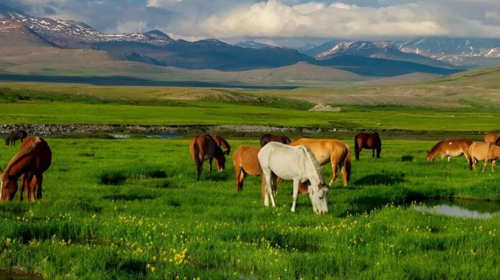
Image Source:https://northerndiscover.com/
Getting to Gilgit-Baltistan from the United States
The journey from the US to Gilgit-Baltistan has three stages. None of them are difficult. All of them require advance planning — particularly the domestic flights, which sell out months ahead during trekking season and are subject to weather cancellations. Before you travel, apply for your Pakistan Tourist eVisa at visa.nadra.gov.pk.
| Step | Stage | Details |
|---|---|---|
| 1 | USA → Islamabad (ISB) | Gulf carriers (Emirates, Qatar, Etihad) offer best connections. Flight time: ~15–18 hours including layover. Cost: $800–$1,400 return. Book 8+ weeks out for summer travel. |
| 2a | Islamabad → Gilgit (GIL) | 1-hour domestic flight via PIA or Serene Air. Views of Nanga Parbat on clear days. Cost: ~$40–80 one-way. Book same day as confirming ground package. |
| 2b | Islamabad → Skardu (KDU) | 1-hour domestic flight. K2 and Karakoram visible on approach. Cost: ~$60–100 one-way. Skardu flights have higher cancellation rate — build in a buffer day. |
| 2c | Karakoram Highway (Islamabad → Gilgit) | 14–16 hours by road. The most spectacular road journey in Pakistan. Recommended for travelers who want the full KKH experience. Break the drive in Chilas. |
| 3 | Ground transport within GB | Hired car and driver is essential. Arrange through your guesthouse or operator. Expect to pay $40–70/day for a local driver with knowledge of roads, conditions, and hidden stops. |
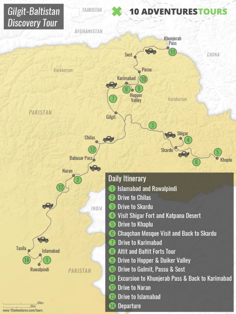
Image Source:https://www.10adventures.com/tour/gilgit-baltistan-discovery/
Domestic flights to Gilgit and Skardu are subject to cancellation in bad weather — mountain flying is unforgiving. Skardu flights cancel more frequently than Gilgit (higher altitude, trickier approach). Always build in at least one buffer day in Islamabad at the start of your trip. If your Skardu flight cancels, road is the backup: 15–18 hrs via the KKH and Indus Highway. Do not book onward international flights immediately after your Skardu departure — allow 48 hours minimum.
When to Go: The GB Seasonal Calendar
Gilgit-Baltistan operates on a strict seasonal rhythm. The mountains dictate the timetable, not the other way around. Arriving outside the right window for your chosen activity is the most common planning error.
| Season | Months | Conditions | What’s Open / Best For |
|---|---|---|---|
| Spring | April–May | Valley floors blooming. Cherry/apricot blossoms in Hunza April. Passes still snowy above 3,500 m. | Hunza Valley, Gilgit, Skardu town. Not yet for K2, Deosai, or Khunjerab. |
| Peak Season | June–August | Best high-altitude window. All treks open. Khunjerab open. Deosai in bloom. 20–27°C in Hunza. | K2 trek, Fairy Meadows, Deosai, KKH, Khunjerab Pass, Rush Lake, all high-altitude treks. |
| Late Summer | September | Excellent conditions. Baltoro still open until mid-Oct. Autumn beginning in Hunza late Sept. | All major treks still viable. Hunza autumn colour starting. Best photography window. |
| Autumn | October–November | Spectacular foliage in Hunza Oct–Nov. K2 trek closes mid-Oct. Lower trails excellent. | Hunza, KKH road trip, Skardu. High-altitude treks closed. |
| Winter | December–March | Khunjerab closed. High passes blocked. Hunza accessible but very cold (-10°C nights). | Gilgit and Skardu towns accessible. Not suitable for trekking or high-altitude travel. |
Sample Itineraries — How to Structure Your Time
7 Days — First-Time Visitor (Hunza + Skardu)
| Day | Plan |
|---|---|
| Day 1–2 | Fly Islamabad → Gilgit. Drive to Karimabad, Hunza. Baltit Fort, Eagle’s Nest, Karimabad Bazaar. |
| Day 3 | Attabad Lake. Boat on the lake, Passu Cones views, drive to Upper Hunza (Gojal). |
| Day 4 | Drive Hunza → Skardu via Gilgit. Stop at Gilgit bazaar and Kargah Buddha. |
| Day 5 | Skardu. Kharpocho Fort, Katpana Cold Desert, Shangrila Lake. |
| Day 6 | Deosai National Park day trip. 4WD jeep from Skardu. Wildlife morning. |
| Day 7 | Fly Skardu → Islamabad. |
12 Days — Full GB Circuit
| Days | Plan |
|---|---|
| Days 1–3 | Hunza Valley — forts, Attabad, Eagle’s Nest, Khunjerab Pass day trip. |
| Days 4–5 | Fairy Meadows — jeep from Raikot Bridge, hike to Nanga Parbat Base Camp. |
| Days 6–7 | Skardu — Kharpocho, Katpana, Shigar Valley, Italian K2 Museum. |
| Days 8–9 | Deosai National Park — overnight camping on the plateau. |
| Days 10–11 | Khaplu Valley — Khaplu Palace, Hushe Valley, Masherbrum views. |
| Day 12 | Fly Skardu → Islamabad. |
18–20 Days — K2 Base Camp + Circuit
| Days | Plan |
|---|---|
| Days 1–3 | Hunza Valley, Attabad, Khunjerab. |
| Days 4–20 | K2 Base Camp Trek (Skardu → Askole → Baltoro → Concordia and return). Add Deosai or Khaplu before or after the trek depending on energy and remaining days. |
What Nobody Tells You Until You’re Already Here
1. Domestic Flights Are the Bottleneck
The most stressed part of any GB trip is not the mountains or the permits — it’s the domestic flight. Book it the same day you confirm your international flights. The Islamabad–Gilgit and Islamabad–Skardu routes fill up months ahead during peak season (July–August). Flight cancellations due to weather are common — especially Skardu. Build buffer days into your itinerary and never schedule a same-day connection to an international flight.
2. Local Drivers Are Not Optional
Gilgit-Baltistan roads are not self-drive territory for visitors. The Karakoram Highway has rockfall, landslide sections, and significant elevation changes that require a driver who knows the road in all conditions. More importantly, a good local driver knows the right stopping points, the best guesthouses, which valley got a fresh landslide last week, and how to read mountain weather. Budget $40–70/day — it’s the best money you’ll spend.
3. Cash Is Still King
ATMs exist in Gilgit, Skardu, and Karimabad but have limited reliability. Carry enough Pakistani Rupees from Islamabad to cover 3–4 days of expenses without access to an ATM. In smaller villages and at campsites, cash is the only option.
4. Acclimatization Matters More Than You Think
Many visitors fly directly into Skardu (2,230 m) and immediately try to drive to Deosai (4,114 m) the same afternoon. This is a reliable recipe for a splitting headache and a wasted day. Allow at least one night at any new altitude before going significantly higher. The altitude gain between Islamabad and Skardu is larger than most people account for.
5. The People Are the Underrated Part
First-time visitors come for the mountains. They leave talking about the people. The Ismaili community in Hunza, the Balti people in Skardu, the Wakhi community in upper Gojal — each with distinct culture, language, and traditions that have been shaped by centuries of mountain isolation and Silk Road crossings. Take the time. Eat with families when invited. Accept the tea. The mountains are extraordinary. The hospitality is unforgettable. Read about it in our Hunza travelogue.
Safety and the State Department Advisory
Gilgit-Baltistan carries no Level 4 travel advisory from the US State Department. The region is entirely separate from the Level 4 zones (Balochistan, KPK/former FATA, and the Line of Control area) that give Pakistan’s overall Level 3 rating its weight.
The practical safety record for international trekking and mountaineering in GB is strong. CNN called the region out by name in its 2025 must-visit list. Over 2,380 foreign climbers and adventurers visited in 2024. The Gilgit-Baltistan Tourism Department actively monitors trail conditions and maintains coordination between operators, the army, and rescue services.
Standard precautions apply: register your trip with the US Embassy STEP program before departure, carry adequate travel insurance including helicopter evacuation coverage, trek with a licensed operator in the Baltoro restricted zone, and research current road and weather conditions before any high-altitude journey.
Frequently Asked Questions
Every trip to GB changes the scale of things.
You arrive thinking you understand mountains. Pakistan has mountains like other countries have hills. The peaks here are not backdrop. They are the environment — visible from every road, every guesthouse roof, every valley floor. After a week in Gilgit-Baltistan, every other mountain landscape in the world feels slightly smaller.
Plan Your Gilgit-Baltistan Trip — Start with TrulyPakistan